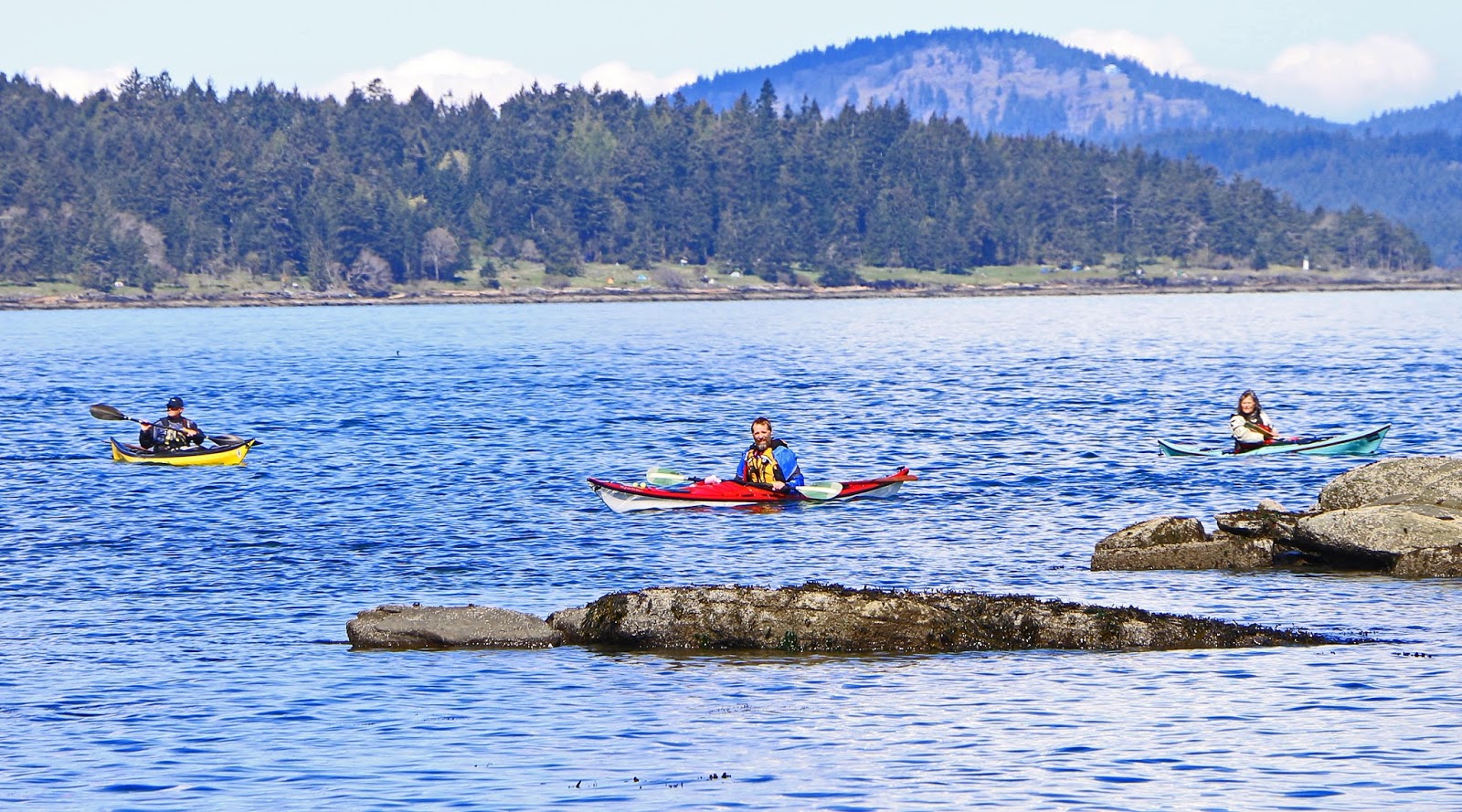
Showing posts with label Portland Island. Show all posts

Friday, August 26, 2016

San Juan Expedition Part 5

Oh It’s Good to Be Back Home Again – Friday May 6th (Day #8)

Oh Canada! Surprise, surprise ….. howling NW winds coming through the Narvaez Bay campground as we woke up. LOL Before deciding about when to start heading towards Bedwell Harbour on Pender Island we decided after breakfast to hike up the Monarch Head bluff and assess the wind before making a decision.

The view from the bluff was pretty spectacular and it was great to get a panoramic of where we had traveled over the past several days. I think for me personally this was the first time that I looked at the San Juan Islands and didn’t think of them as some mysterious paddling destination of many unknowns. They had been our home, place of refuge and I knew that some day we would return to further explore their waterways and islands that are so close to Victoria.

 We were just there ... L to R Patos Island, Mt. Baker and Sucia Island and ...
a ship that we didn't have to play Frogger with LOL

Looking towards Sidney Island with a freighter rounding Stuart Island. Some pretty good rip tides too! 

From the bluff the winds off shore were still blowing fairly decently but we felt that we could paddle along the shoreline towards Taylor Point before crossing Plumper Sound to the Pender Islands. On the way back to camp we stopped at the picturesque point near the campsite and spotted our first humpback whale on the trip surfacing several hundred feet away. We also managed to locate one of the Gulf Islands National Park Reserve's Top Ten Caches (GC2XHJK - Best place to meditate) that the GINPR staff activated back in 2011.

A humpback whale in Narvaez Bay

The San Juan Expedition crew L to R: Mark, Kari, Robyn, Michael and Lynn

Launching at noon we rounded Monarch Head and found ourselves slogging our way through a strong head wind and with a flood current as we passed Cactus Point. Only less that 100 feet from the shoreline it became obvious that we weren’t getting anywhere fast as the wind gusted stopping our forward progress. Michael decided to tow Lynn and they started to make good progress so I decided to in-line tow Kari and Robyn and slowly we started making some head way towards the little sheltered beach at Taylor Point. Out of all the paddling that we had done up to this point on the trip I found this to be the most challenging from a physical perspective. Traveling at just about 1nm per hour we finally reached Taylor Point almost 2 hours later and I was totally exhausted.

The beach at Taylor Point. Only 2 nm away is Cactus Point and it took us 2 hours to get here.

While the group was resting on the beach Michael paddled around the point to check out the conditions in Plumper Sound and returned with good news that the winds weren’t as bad. Continuing on our way we crossed the sound and into Port Browning, through the cut and to the Poet’s Cove Marina / Resort & Spa to check in with Canada Customs. We let Robyn make the call to the customs officer by telephone (who knows where) advising the gentlemen on the other end of the line that we were 5 kayakers returning into Canada. His only comments were if we were bringing anything illegal back into the country and then provided his badge number to us as our form of clearance into the country. It was that easy!!  LOL

Heading towards the cut between South and North Pender Islands

Lynn points out a Canada Customs sign or just common sense?

Poet's Cove Marina and Syrens Marine Pub close by to calling Canada Customs


Nothing tastes better than the first meal back in civilization!

Since we were already at the marina we decided to have dinner and drinks at Syrens Marine Pub, bought some off sales beer and then proceeded to head across the cove to Beaumont Park to set up camp. Beaumont was a nice surprise as it is situated in a little protected bay and there was only one other couple there. We set up camp in a clearing in the trees while defending ourselves from the hungry mosquitoes.  Sleep came easy that night not a breath of wind to disturb us.


2016 Paddle #23 - Narvaez Bay (Saturna Island) to Beaumont Park (South Pender Island)
Distance: 10.00 nm (18.52 km)
Trip: 69.23 nm (128.21 km)
YTD: 215.12 nm (398.40 km)


One Last Stop - Saturday May 7th (Day #9)

Camp set up in the trees at Beaumont Park

A nice shell beach to leave our kayaks

The next morning, we woke up to another beautiful day with no wind and I found the huge composting outhouse that is set back in the forest and spotted a Pileated Woodpecker nearby.

The nice composing outhouse

Pileated Woodpecker searching for grubs in a nearby log

The plan was to launch at 10:00am and since Lynn and Michael were ready early they headed out about half an hour ahead of Robyn, Kari and myself with a plan to meet up with them somewhere at Moresby Island.

As Robyn, Kari and I headed around Wallace Point it became evident That we would not be able to hug the shoreline due to the ebb current running around the point so instead we cut across the eddy lines and out into open water and started heading across Swanson Channel towards Moresby Island. 

We must be close to home if we have to wait for BC Ferries

We spotted Lynn and Michael near Pelorus Point (Moresby Island) and upon reaching them we waited for a BC Ferry to pass before continuing onto to Arbutus Point on Portland Island where we set up camp for our last night. To our surprise there was only one other kayaker who was visiting from Washington State. After establishing camp we hiked the trail through the middle of the island to Princess Bay completing the loop on the coast trail back to camp. Since we had an excess of water still with us Robyn and I decided to set up the shower above the high water line which was an amazing treat!! At least we would be heading home the next day smelling half decent. LOL

Relaxing around camp on Arbutus Point

Kari enjoying the calm blue ocean.

This is a view that we have seen before from Arbutus Point only this time we can say that we
have been there.  Mt. Baker in the background, South / North Pender Island on the left, just to the
 left of the red marker light is Sucia Island (USA) in the distance, to the right of the marker is
Waldron Island (USA) an Moresby Island on the right.


2016 Paddle #24 - Beaumont Park (South Pender Island) to Arbutus Point (Portland Island)
Distance: 7.19 nm (13.31 km)
Trip: 76.42 nm (141.53 km)
YTD: 222.31 nm (411.71 km)


Homeward Bound - Sunday May 8th (Day #10)

Our last morning of the trip we woke up to ….. wait for it ….. a little bit more wind but at least it was going the right direction towards Sidney. Michael had to leave a little bit ahead of schedule to meet his arranged ride and the rest of us followed a couple of hours later enjoying a nice leisurely paddle back to Sidney arriving at Van Isle Marina just after noon. 

Our 10-day trip to the San Juan Islands is now in the books so to speak we’ll return sometime soon. Our first visit to the San Juan’s really was an expedition to see what was there and we learned a lot on this short trip. One thing for sure is that the water through the San Juan Islands seems to be always moving (currents) and if the wind comes up if can get a little interesting. We only touched the tip of the iceberg regarding places to visit and would like to see what is south and east of Grays Harbour. Our next trip will probably be direct to Grays Harbour via the Washington State ferry from Sidney which will save paddling across the potentially busy shipping lanes. We’ll take at least 2 weeks to further explore these islands so close to home yet not on most kayakers to do list. Until next time …


2016 Paddle #25 - Arbutus Point (Portland Island) to Van Isle Marina
Distance: 5.41 nm (10.01 km)
Trip: 81.83 nm (151.55 km)
YTD: 227.72 nm (421.73 km)

Note: More pictures of the entire San Juan Islands trip can be found by following the link HERE

Friday, April 8, 2016

2016 Easter on Portland Island

Storm after storm after storm has been the weather pattern the past month or so but things were starting to look a bit better heading into the Easter long weekend. After checking the camping gear (minimizing again) we decided that we would head to Arbutus Point on Portland Island for 4 days. We really didn't care what the weather would do as long as the winds didn't stop us going or coming back home. Tarps, rain gear and multiple layers of warm clothes were packed along with what seemed like a whole fridge of food (we really need to work on that).

We meet up with Beverely (and Bella the dog), Lynn and Morley at Van Isle Marina in Sidney at 07:30am to take advantage of the predicted light winds and a slowly increasing ebb which we would be paddling against. For Robyn and I this was our first time launching at the marina and I must say what the heck were we thinking of the last 3 years launching from some of the local beaches with limited parking? Van Isle Marina has a nicely paved unloading area which allowed us to load and wheel our kayaks down the ramp with ease. And ... a great parking lot to leave the car in!

Launching out of Van Isle Marina

Leaving the ramp at 08:30am we headed towards our destination via John Passage, Pym Island and on to Shell Beach. As expected the ebb currents were starting to build and it was a bit of slog approaching Brackman Island so decided to take a rest stop at Shell Beach, which to my surprise was completely empty of campers. While stretching our legs we spotted Jo not far behind us so we waited for her to catch up to us and continued on our way to Arbutus Point.

One of the things about arriving at Arbutus Point is that you never know who might be there especially on a long weekend. To our surprise there wasn't a soul around so we had our choice of the tent pads and one of the first things I noticed was a new kiosk welcoming travelers like us.

The new welcome sign
  
The sign welcomes visitors to SXEĆOŦEN and explains that for thousands of years the Coast Salish have considered Portland Island to be part of their traditional territories. SENĆOŦEN is one of the Coast Salish languages spoken in this area and SXEĆOŦEN is the traditional name for the island which translates to "dry mouth".

Life is tough .... enjoying the sunshine

Some of the recent upgrades to the campsite include a new metal food cache, composting outhouse and each pad site has a new picnic table. The changes are a welcome sight as the last time we visited in late 2014 I thought Arbutus Point was starting to look a little run down. We went to work setting up camp which included tarps over the tents and tables since rain was in the forecast later that night. As we were relaxing after brunch, fellow paddlers Dave, Kevin and Gene arrived from Mill Bay and somewhere Reale and Jeff were still on the water.

Dave, Kevin and Gene arrive after paddling from Mill Bay

As our group number was increasing it pretty well took up all of the available tent pads except for one until a super pod (10+) of kayaks and canoes started to arrive just after noon. One by one they landed on the crescent beach behind the campground and came into the camping area surprised to find us here. As it turns out they were a nice bunch of people who had been coming to Arbutus Point at Easter for the past 10 years or so. While they were deciding what they were going to do about camping our group headed out to hike around the island. The coastline trail seems to be a ritual for us when ever we visit the island but there also is a central trail that Robyn and I have never explored.

Morley, air cast and all made the trip and catches up on some reading around camp.

Taking approximately 2 hours to complete the circumnavigation of the island, we stopped at the Shell Beach and Princess Bay campgrounds and surprise, surprise they were both completely empty (still). Shell Beach is a wonderful location to spend a weekend but can be a popular spot for power-boaters and occasionally is a party beach. Princess Bay is a grassy meadow like campsite near an old orchard but on this day it was pretty wet and 'boggy' which would make setting up camp pretty difficult.

Brackman Island just off Shell Beach


Jo heading back home
Arriving back at Arbutus Point we found the "Easter group" of campers scattered through the trees behind the main camping area. Obviously they must have done this in past years with the number of people in their group. Reale and Jeff had also arrived while we were away but unfortunately Jo need to start heading back home to look after her sick kitty.


We spent the rest of the afternoon and early evening sharing stories and enjoying each other company before heading off to our inviting tents just near dusk. The forecast for the evening was for rain and just after we climbed into our sleeping bags it started to pour. However, it was comforting knowing that our tarps were doing their job and so were my ear plugs as I drifted off to sleep :-)

On Saturday morning we woke up to clearing skies and our group started making plans for the day after breakfast. Gene, Dave and Kevin would be heading back to Mill Bay as there was a potential for high westerly winds on Sunday. Reale, Beverely and Jeff decided they would also be heading back towards Victoria but only after paddling over to Point Fairfax on Moresby Island. Robyn, Lynn, Morley and I headed out on a circumnavigation of Moresby Island which we have never done before. I must say that it is fantastic day trip from Portland Island and it also gave us the opportunity to get a closer looker of a destination we are heading to at the end of April. Where you might be wondering? The San Juan Islands!!

Stuart Island, one of the San Juan Islands on the left and Rum Island on the right. A short paddle across Haro Straight.

Lunch stop near Point Fairfax

Zzzzzzzzzzzz
We stopped for lunch and a nap for me on a nice little crescent beach on the west side of Point Fairfax. At last reported, Moresby Island was up for sale in the neighborhood of 50 million dollars. It would be nice to see a good chunk of the island designated as a new Gulf Island park but that probably won't happen in my lifetime. Arriving back at camp our little band of travelers were now down to the four of us and the Easter group which now had a couple of additions not related to them. It seems that 2 Russian speaking fellows arrived by stand up paddle boards and they too were camped back in the woods.


Relax, relax relax ....... repeat!
The Easter group gathered on the crescent beach just behind the campsite to cook a turkey on in a portable dish like hibachi and they even came by and offered us some too but we politely declined as we had just finished our dehydrated meals. For the rest of the evening we just hung out on the bluff near our tents and simply watched life go by. :-)

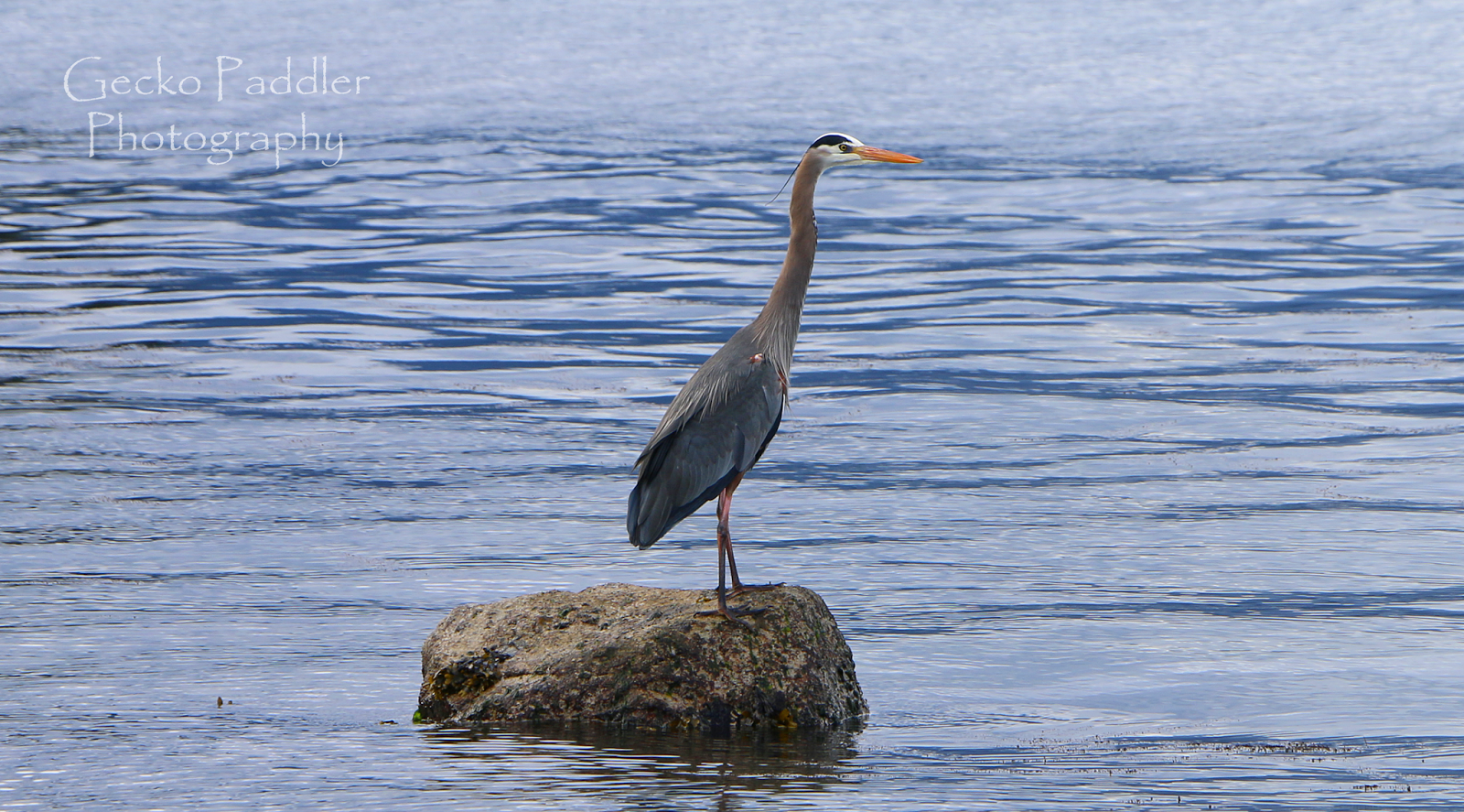
I took the time to shoot some pictures of birds along the shoreline.


My first picture of an Oyster Catcher

Great Blue Heron

Sunday morning was a real lazy start to the day, no rush, two cups of coffee and I went for a full breakfast consisting of hash browns, bacon and eggs. Robyn and I decided to hike the trails inside the island while Lynn and Morley did a little hiking on their own. Morley recently got back to kayaking after suffering a skiing injury over Christmas. Even this weekend he was is still in his air cast while his torn Achilles tendon is healing. He did quite well around camp on his crutches and is happy to be able to paddle again.

The trails inside the island were a wonderful surprise of raised board walks, tall fir trees and even several large arbutus. I'm glad I brought my new Canon 70D SLR with 18-135mm lens with me on this trip and I used a lot of time to shoot over 800 pictures mostly because I was trying out different modes, shutter and aperture settings.


Raised boardwalk on the Kanaka Trail

Very quiet and beautiful on the interior trail


Dark Eyed Oregon Junco ... who sees who? 

The magic of the weather. 

Arriving back at camp we settled in for some early appetizers and as the weather forecast predicted we were graced by several rain squalls coming from the northwest. They say every cloud has a silver lining and for us it was much more colorful.


Our last sunrise before packing up and heading home

Monday morning we woke up to partly sunny skies and a building wind from the north (as predicted). After a quick breakfast we dismantled camp and headed onto the water as white caps were building in Swanson Channel. As we all expected the winds decreased to almost to nothing once we reached Shell Beach because we were now in the wind shadow of Portland Island. We made our way back to Swartz Bay in full sunshine and took the scenic route through Page Passage and into Tsehum Harbour and finally back at Van Isle Marina.

It's official ..... kayak camping season is now full on!!


2016 Paddle #8 - Van Isle Marina to Portland Island
Distance: 5.00 nm (9.26  km)
YTD: 60.77 nm (112.23 km)

2016 Paddle #9 - Arbutus Point to Moresby Island
Distance: 8.80 nm (16.30  km)
YTD: 69.57 nm (128.53 km)

2016 Paddle #10 - Portland Island to Van Isle Marina
Distance: 5.08 nm (9.40  km)
YTD: 74.65 nm (137.93 km)

Friday, June 19, 2015

Portland Island - The Unofficial Westcoast Paddler Camp Out

It was a good thing that we decided not to head to Portland Island on Thursday evening as mid summer wind storm hit south coast that night.  Instead we decided to get up early on Friday morning and paddle over to Portland Island for our first cup of coffee. The wind had subsided overnight and the glorious sunshine was once again bringing warmth and calm conditions for to us. Since we were getting an early start to the day we took a chance and drove to the Swartz Bay government dock in hopes of finding a parking spot. To our surprise there were several empty spots available which meant that our paddle to Portland Island would be shortened by about half an hour.

Ready to launch at the Swartz Bay government dock early Friday morning. Time to paddle to Portland Island for coffee!

Launching just after 9:00am we were able to take advantage of the turn to flood that would carry us all the way to Arbutus Point on the north end of Portland Island. Leaving from Swartz Bay really cuts the transit time down as we landed just after 10:30am after a leisurely paddle with little wind.

Passing Shell Beach which had no signs of campers.

Approaching Arbutus Point it looked like our campground was completely empty until we landed and started to explore the upland where we found Philip Torrens who was just finishing breakfast. Philip arrived the evening before under sail and told us that the wind wasn't that bad at this location on Haro Straight. It turns out that the highest winds missed the tip of the Saanich Peninsula and we could have attempted the paddle the evening before.

Robyn and Philip enjoying the sunshine and getting caught up with what has happened over the past year.

After setting up camp and having breakfast we spent the rest of the day just relaxing in the sun chatting with Philip as other kayakers arrived. The thing about this annual camp out is that you never know who is coming so it becomes a bit of a waiting game to see who might show up. Sheila and Neil landed at around 3:00pm followed by Yves and Patti of Go Kayak along with Michel closer to dinner time.

Sheila and Neil arrive

Followed by Yves, Patti and Michel

The Friday evening sun worshipers

We gathered on the beach after dinner and watched the sun set through the clouds over Salt Spring Island like a fiery volcano. Sunsets at Arbutus Point are always spectacular which makes it one of our favorite places to camp.

Friday evening sunset over Salt Spring Island

Looking like a album cover of an 80"s band in the Saturday morning sunshine

Shell Beach... empty mid day Saturday
Saturday morning we woke early to clear skies with brisk north winds. Yves and Patti joined us for a hike around the island while the others decided to relax back in camp. At Shell Beach we spotted a kayak heading towards the north end of the island so it looked like our little band of campers would be getting bigger later in the day. Arriving back at camp we spent the rest of the day soaking up the sun on the little shell beach as Rod arrived with word that Joanne and Doug were not far behind. Doug is a relatively new kayak camper (like first time) and it was fun to watch him unload his gear for a single overnight. It brought fond memories back to when Robyn and I arrived at the 2012 WCP camp out for our first time. Back then we brought everything including the kitchen sink and on this trip, so did Doug. LOL


Soon it was time to start preparing for the pot luck dinner and it has been our custom to provide a big plate of scallops and bacon. As usual there was tons of food to go around. Normally the camp out happens in April and we all huddle under Dan Millsip's big top tent to keep warm :-) but being June we had dinner on the beach instead.


We also had a birthday to celebrate as Sheila turned 24 :-) so we all sang happy birthday to her and then had individual bite size chocolate cupcakes that Rod brought. Haaaaaapppy Birthday Sheila!


Joanne brought Sheila a birthday gift which every paddler should have. John Kimantas' "The BC Coast Explorer" Volume 2 which covers the south coast of Vancouver Island, from Bamfield to Comox Harbour including the West Coast Trail, the Juan de Fuca Trail, Greater Victoria, Saanich Peninsula, the Gulf Islands, Bellenas-Winchelsea Archipelago, Denman and Hornby Islands and finally Comox Harbour.


Philip preaches to the wild coast campers! LOL
Once again Philip provided the entertainment for the evening showing off his Exped DreamWalker summer version sleeping bag. This isn't your ordinary sleeping bag as it can be morphed into a short jacket, vest or whatever you want it to be.

For those who have never heard the story before, he then told the tail of being almost eaten alive by a polar bear while trying to paddle through the northwest passage a number of years ago. Trapped inside his tent with another paddler, a polar bear picked him up by his foot only to be scared off when his companion fired off a blast from their shotgun through the tent. There are not too many people alive who can say that their foot was in a polar bear's mouth and who managed to live to tell about it. Philip has been there and done that!


Joanne had to depart after dinner so we watched her paddle off into the setting sun.

Another magical setting sun ends the day.

They were there, but only a couple of well behaved ones.
After the sun set behind Salt Spring Island the group dispersed to their tents after a wonderful day. The weekend was ending and once again our group would be disbanding until next year.

Sunday morning we woke to the best day yet with only a very slight breeze coming from the north. Our plan was to be on the water around 10:00am so that we could catch the last of the ebb back towards Swartz Bay. After saying our goodbyes for another year, we joined Sheila and Neil for the paddle along the eastern shoreline to our put in location. It was another great West Coast Paddler camp out and we can't wait for the 2016 gathering. I think June is waaaaay better than April. Just sayin ;-)


Almost back at the put in, Sheila and Neil pass by the ferries at Swartz Bay.


2015 Paddle #21 - Westcoast Paddler Camp Out
Distance: 7.64 nm (14.15 km)
YTD: 183.90 nm (‪340.58 km)