Friday, August 26, 2016

San Juan Expedition Part 5

Oh It’s Good to Be Back Home Again – Friday May 6th (Day #8)

Oh Canada! Surprise, surprise ….. howling NW winds coming through the Narvaez Bay campground as we woke up. LOL Before deciding about when to start heading towards Bedwell Harbour on Pender Island we decided after breakfast to hike up the Monarch Head bluff and assess the wind before making a decision.

The view from the bluff was pretty spectacular and it was great to get a panoramic of where we had traveled over the past several days. I think for me personally this was the first time that I looked at the San Juan Islands and didn’t think of them as some mysterious paddling destination of many unknowns. They had been our home, place of refuge and I knew that some day we would return to further explore their waterways and islands that are so close to Victoria.

 We were just there ... L to R Patos Island, Mt. Baker and Sucia Island and ...
a ship that we didn't have to play Frogger with LOL

Looking towards Sidney Island with a freighter rounding Stuart Island. Some pretty good rip tides too! 

From the bluff the winds off shore were still blowing fairly decently but we felt that we could paddle along the shoreline towards Taylor Point before crossing Plumper Sound to the Pender Islands. On the way back to camp we stopped at the picturesque point near the campsite and spotted our first humpback whale on the trip surfacing several hundred feet away. We also managed to locate one of the Gulf Islands National Park Reserve's Top Ten Caches (GC2XHJK - Best place to meditate) that the GINPR staff activated back in 2011.

A humpback whale in Narvaez Bay

The San Juan Expedition crew L to R: Mark, Kari, Robyn, Michael and Lynn

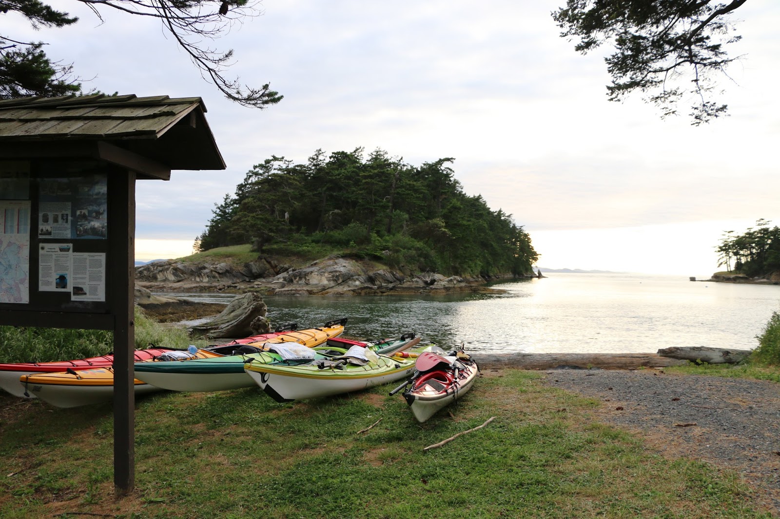
Launching at noon we rounded Monarch Head and found ourselves slogging our way through a strong head wind and with a flood current as we passed Cactus Point. Only less that 100 feet from the shoreline it became obvious that we weren’t getting anywhere fast as the wind gusted stopping our forward progress. Michael decided to tow Lynn and they started to make good progress so I decided to in-line tow Kari and Robyn and slowly we started making some head way towards the little sheltered beach at Taylor Point. Out of all the paddling that we had done up to this point on the trip I found this to be the most challenging from a physical perspective. Traveling at just about 1nm per hour we finally reached Taylor Point almost 2 hours later and I was totally exhausted.

The beach at Taylor Point. Only 2 nm away is Cactus Point and it took us 2 hours to get here.

While the group was resting on the beach Michael paddled around the point to check out the conditions in Plumper Sound and returned with good news that the winds weren’t as bad. Continuing on our way we crossed the sound and into Port Browning, through the cut and to the Poet’s Cove Marina / Resort & Spa to check in with Canada Customs. We let Robyn make the call to the customs officer by telephone (who knows where) advising the gentlemen on the other end of the line that we were 5 kayakers returning into Canada. His only comments were if we were bringing anything illegal back into the country and then provided his badge number to us as our form of clearance into the country. It was that easy!!  LOL

Heading towards the cut between South and North Pender Islands

Lynn points out a Canada Customs sign or just common sense?

Poet's Cove Marina and Syrens Marine Pub close by to calling Canada Customs


Nothing tastes better than the first meal back in civilization!

Since we were already at the marina we decided to have dinner and drinks at Syrens Marine Pub, bought some off sales beer and then proceeded to head across the cove to Beaumont Park to set up camp. Beaumont was a nice surprise as it is situated in a little protected bay and there was only one other couple there. We set up camp in a clearing in the trees while defending ourselves from the hungry mosquitoes.  Sleep came easy that night not a breath of wind to disturb us.


2016 Paddle #23 - Narvaez Bay (Saturna Island) to Beaumont Park (South Pender Island)
Distance: 10.00 nm (18.52 km)
Trip: 69.23 nm (128.21 km)
YTD: 215.12 nm (398.40 km)


One Last Stop - Saturday May 7th (Day #9)

Camp set up in the trees at Beaumont Park

A nice shell beach to leave our kayaks

The next morning, we woke up to another beautiful day with no wind and I found the huge composting outhouse that is set back in the forest and spotted a Pileated Woodpecker nearby.

The nice composing outhouse

Pileated Woodpecker searching for grubs in a nearby log

The plan was to launch at 10:00am and since Lynn and Michael were ready early they headed out about half an hour ahead of Robyn, Kari and myself with a plan to meet up with them somewhere at Moresby Island.

As Robyn, Kari and I headed around Wallace Point it became evident That we would not be able to hug the shoreline due to the ebb current running around the point so instead we cut across the eddy lines and out into open water and started heading across Swanson Channel towards Moresby Island. 

We must be close to home if we have to wait for BC Ferries

We spotted Lynn and Michael near Pelorus Point (Moresby Island) and upon reaching them we waited for a BC Ferry to pass before continuing onto to Arbutus Point on Portland Island where we set up camp for our last night. To our surprise there was only one other kayaker who was visiting from Washington State. After establishing camp we hiked the trail through the middle of the island to Princess Bay completing the loop on the coast trail back to camp. Since we had an excess of water still with us Robyn and I decided to set up the shower above the high water line which was an amazing treat!! At least we would be heading home the next day smelling half decent. LOL

Relaxing around camp on Arbutus Point

Kari enjoying the calm blue ocean.

This is a view that we have seen before from Arbutus Point only this time we can say that we
have been there.  Mt. Baker in the background, South / North Pender Island on the left, just to the
 left of the red marker light is Sucia Island (USA) in the distance, to the right of the marker is
Waldron Island (USA) an Moresby Island on the right.


2016 Paddle #24 - Beaumont Park (South Pender Island) to Arbutus Point (Portland Island)
Distance: 7.19 nm (13.31 km)
Trip: 76.42 nm (141.53 km)
YTD: 222.31 nm (411.71 km)


Homeward Bound - Sunday May 8th (Day #10)

Our last morning of the trip we woke up to ….. wait for it ….. a little bit more wind but at least it was going the right direction towards Sidney. Michael had to leave a little bit ahead of schedule to meet his arranged ride and the rest of us followed a couple of hours later enjoying a nice leisurely paddle back to Sidney arriving at Van Isle Marina just after noon. 

Our 10-day trip to the San Juan Islands is now in the books so to speak we’ll return sometime soon. Our first visit to the San Juan’s really was an expedition to see what was there and we learned a lot on this short trip. One thing for sure is that the water through the San Juan Islands seems to be always moving (currents) and if the wind comes up if can get a little interesting. We only touched the tip of the iceberg regarding places to visit and would like to see what is south and east of Grays Harbour. Our next trip will probably be direct to Grays Harbour via the Washington State ferry from Sidney which will save paddling across the potentially busy shipping lanes. We’ll take at least 2 weeks to further explore these islands so close to home yet not on most kayakers to do list. Until next time …


2016 Paddle #25 - Arbutus Point (Portland Island) to Van Isle Marina
Distance: 5.41 nm (10.01 km)
Trip: 81.83 nm (151.55 km)
YTD: 227.72 nm (421.73 km)

Note: More pictures of the entire San Juan Islands trip can be found by following the link HERE

Friday, August 5, 2016

San Juan Expedition Part 4

The Patos Island Waiting Game - Thursday May 5th (Day #7)

The one thing about wind forecasts is that they usually tend to be correct around here and sure enough ours was. After finally falling asleep after a long day I woke up in the middle of the night only to hear the winds starting to rustle the trees around our little protected campsite. Great ..... Not!

The Holland America Rotterdam passes by Patos Island

Although we had nice clear skies the NW wind was blowing 25-30 kt which meant that we weren’t going anywhere this morning. Instead we decided that we would hike around the island and go visit the Patos Lighthouse National Park Monument and do a little geocaching too. We did watch a cruise ship come up Boundary Passage heading towards Vancouver through some pretty big seas. We even saw a BC Ferry on the Swartz Bay to Tsawwassen route detour around Saturna Island as we heard the conditions near Active Pass were pretty bad on this day.

Sitting around camp after breakfast we were watching the interaction of the wind and water when Lynn called out “whales”. Sure enough just off shore a pair of mature orca and a baby were passing by and the little fella put on a bit of a show breaching every so often. After paddling so far through the San Juan Islands we were a little disappointed not to have seen any whales up to this point so this was a special treat for us.

Mom and baby

Mom tail slapping

The baby puts on a show.

After the whale show we headed to the lighthouse to check out the buildings and to see what the conditions were like off Alden Point. Walking through the forest we arrived at the lighthouse passing by the old foundations of buildings that once were the home to the lighthouse keeper and his family. By the time we reached the point we had the full force of the winds blowing in our faces as the flood tide was interacting with the wind creating a huge tide race. One thing for sure was that we wouldn’t be paddling in these conditions any time soon and we started thinking that we might be staying on Patos Island for a few days.

Walking the trail to the lighthouse

An enormous tide race off Alden Point

The girls capturing a selfie

In the distance a container ship enters Boundary Passage

For a little bit more history on the Patos Island Lighthouse please visit this link HERE


Continuing on our way we completed the hike around the east side of the island and located one of the geocaches and then followed the trail through dense under growth that took us back to our campsite on the west side of the island. Lunch and siesta time was enjoyed in the warm sun as we sheltered ourselves under a rocky shelf at the campsite.

Kari finds the geocache

Michael checks out one of the items in the cache. 

Back at camp Michael does some reading

Kari reading while I'm fast asleep LOL

Later in the afternoon we decided to head back to the lighthouse for another look at the conditions because the long range forecast was calling for the winds to diminish late in the afternoon. What we were really looking for is how the slack tide would start to look like as the winds dropped near dinner time. With any luck …..

Sure enough the wind was dropping and after checking all available information via the internet and VHF radio we decided to break camp and be ready to leave at around 5pm. One last check of the 4:30pm Environment Canada Marine Report and we decided to head out and make a run across Boundary Passage towards Saturna Island.

Our original thoughts during the trip were to maybe make it to Tumbo Island off East Point but with the NW winds and the slack just starting to turn to an ebb it clearly became evident that this wasn't possible. Even though the winds were becoming lighter we did experience some significant rip tides which made the crossing a little interesting but thankfully we didn’t have to contend with any tanker or container ships. I stuck with Robyn and Kari while Michael stuck with Lynn through the bumpiest part of crossing and we even had a pod of porpoise playing in the rips that we paddled through.

Entering the protected water of Narvaez Bay 

Finally, in the wind shadow of Saturna Island we paddled into Narvaez Bay just before 7:30pm and began hauling our gear up the trail to the campground. After being spoiled with the Washington State Park system of well serviced campgrounds I felt a bit shell shocked establishing camp at this Parks Canada Gulf Islands National Park Reserve. This was the first time that Robyn and I had come to this campground that is situated on a really pretty point in Narvaez Bay but the camping area is placed well back from the point. We found three tent designated areas right near the visitor kiosk and for some reason there are also two picnic tables jammed right up to it. All this open space in the park yet the camping area is packed together like a mini tent city.

Our 3 tents in sites and the picnic tables at Narvaez Bay that are crowed around the visitor kiosk.
One has to wonder what the PCGINPR was thinking when establishing this site??

 After establishing camp Robyn and I went to work on making the group dinner which we enjoyed as the last bit of sunlight left our camp.  As for the outhouse …. Well it certainly had a lot to be desired compared to being spoiled the past week but it was an outhouse (less toilet paper) but it still beats digging a cat hole anytime. LOL After another long day I think we all slept very, very well that night back home in Canada! Hey! .... We still need to check in!!


2016 Paddle #22 - Patos Island to Canada
Distance: 6.20 nm (11.48 km)
Trip: 59.23 nm (109.69 km)
YTD: 205.12 nm (379.88 km)


Note: More pictures of the entire San Juan Islands trip can be found by following the link HERE

Monday, August 1, 2016

San Juan Expedition Part 3

Sucia Island Touring - Tuesday May 3th (Day #5)

We woke up to cloudy skies after a few showers during the night. After breakfast Robyn, Kari and I decided that we would spend the day hiking around the island looking for some of the geocaches on the island. Michael and Lynn decided that they would circumnavigate the island by kayak and hopefully we would see them while we were hiking.

It's hard to imagine that this jewel of an island only cost $25,000 back in 1960.

Sucia Island has over 10 miles of hiking trails weaving along the shoreline or through the forest that covers most of the island. Like we do on most of our trips, Robyn uses her GPS to find any geocaches that might be in the area so we decided to head towards Ewing Cove locating several caches along the way with the last one giving us a view of the Cluster Islands. One of the great things about Sucia Island is that it has over 60 campsites spread out through the 564-acre marine park and we soon found out that we were the only ones actually camping on the island during our stay.

A view of the two privately owned Finger Islands and Matia Island
3 miles in the distance from the Echo Bay campsites

Walking along the shoreline trail high above the water near Wiggins Reef we spotted Michael and Lynn paddling into Echo Bay. From our vantage point we could see Matia and Clark Islands and all the way down to Lawrence Point several miles away.

We spotted Lynn and Michael while hiking to Ewing Cove

We came across several of the Washington State Parks composting outhouses that I consider to be 5 star in terms of camping amenities and the one at Ewing Cove just might have been my favorite on the whole trip.

I never thought outhouses would be so attractive to visit and look at.

Not the usual thing that one finds in a geocache. LOL

Our return route was via Shallow Bay which was home for many of the Chinese workers who were illegally imported as laborers in the late 1800’s and early 1900’s. Contrary to the name, the Chinese hid in the forest and not in the China Caves that can be found at Shallow Bay.

Shallow bay offers a big sandy crescent moon beach with several campsites

The China Caves that weren't actually used by Chinese workers to hide in. Still, pretty cool to see.

Returning back to camp I spent some time setting up my hammock for a much needed nap and then went to work rigging up a shower area in a vacant campsite nearby.

I rigged a tarp to provide privacy in our shower area near the edge of a cliff in the site next to us.

We noticed a large group of people walking up the trail from the Echo Bay marina and they turned out to be part of a Sucia Island tour from Orcas Island. As we watched them look around Fossil Bay we noticed a couple with Geocaching patches on their packs and talked with them for a bit. They told us that on the way to the island they spotted a pod of orca not far from shore close to our location and as luck would have it, we were out hiking during that time.

Lots of fossil on the cliff side near our campsite.


We spent the rest of the day checking out the fossils on the cliff near the camp or just lounging around camp as Kari spotted what looked to be very large sandpipers with long curved beaks on the beach below us. Checking my bird book, we figured out that they were migrating Whimbrels which we had never seen before. After dinner we sat around the campfire and checked the 9:30pm forecast only to be surprised by a building NW 20+ knot wind forecast that was supposed to happen during the middle of the night.


Waiting for Patos Island - Wednesday May 4th (Day #6)

Right on schedule just around midnight the NW 20 knot winds came up fast and started rattling our little camp. After having very little wind at all on the trip it was a bit annoying trying to sleep while our tarps and tents took the brunt of the gusts that came through our little tombolo campsite.

When we finally woke up in the morning the skies were overcast with a little drizzle and the winds were continuing to blow pretty good. Listening to the extended forecast it looked like we might see the winds start to diminish later in the day and we decided that might be our opportunity to head towards Patos Island only 3 miles north of us.

Riding out the drizzle Kari's does some reading and I work on a taut knot that Michael showed me.


In the meantime, we suited up in our rain gear and all went for a little hike to EV Henry Point to locate a geocache and get some great views of the area from high up on the cliffs above the fossil beds.

Michael, Robyn, Kari and Lynn

Great view from EV Henry Point. Saturna Island way in the distance and our little campsiteon the
tombolo under the trees. From this location wecould see how the current was interacting with the
NW winds.

We had no idea what the heck this trail marker meant other than maybe "You are here" LOL

Returning to camp we made lunch and decided to head out on another hike to Johnston Point but half way there the sun started to come out and the winds slowly started to reside. We had a little group discussion and decided to head back to camp to pack up and wait for an opportunity to head to Patos Island.

Launching towards the sunset for Patos Island.
We had a window of opportunity to make a run for the island and off we went.

Just after 5pm we took to the water and paddled in choppy conditions due to the wind and current working against us but we managed to land on Patos Island at around 7pm.

Our kayaks tied up for the night near the campsite kiosk

The main camping area that is exposed to the elements.

The camping area was on a nice little point that offers views of Sucia Island to the south and Saturna Island to the north but we found a site protected from the wind in the trees.

What might be home for the next couple of days. Nice and cozy if the winds keep howling.

The winds continued to decrease a bit and we were blessed with one of the most amazing sunsets that I have ever seen as we sat around a campfire on the point to watch the sun go down. Just before heading to bed we checked the forecast for the next day and it wasn’t looking good with the NW winds stating to blow again overnight. It was beginning to look like we might be staying on Patos Island for a couple of days.


2016 Paddle #21 - Sucia Island to Patos Island
Distance: 3.09 nm (5.72 km)
Trip: 53.03 nm (98.21 km)
YTD: 198.92 nm (368.40 km)

Note: More pictures of the entire San Juan Islands trip can be found by following the link HERE