Showing posts with label Oak Bay Marina. Show all posts

Saturday, October 28, 2017

Endless Summer!!

October 28th and it was 18°C or 65°F in Victoria, BC. I can't remember when I last got a sun burn this late into the year but it happened.

After a busy couple of months volunteering our time with Santa's Anonymous and the Rocky Point Bird Observatory we managed to finally get back out in our kayaks on such a stunning fall day. Our original plan was to launch out of the Oak Bay Marina and paddle south long the shoreline but as we approached Trail Island the conditions were perfect for us to cross Enterprise Channel and paddle to the lighthouse.

Paddling past the Victoria Golf Club at Gonzales Point

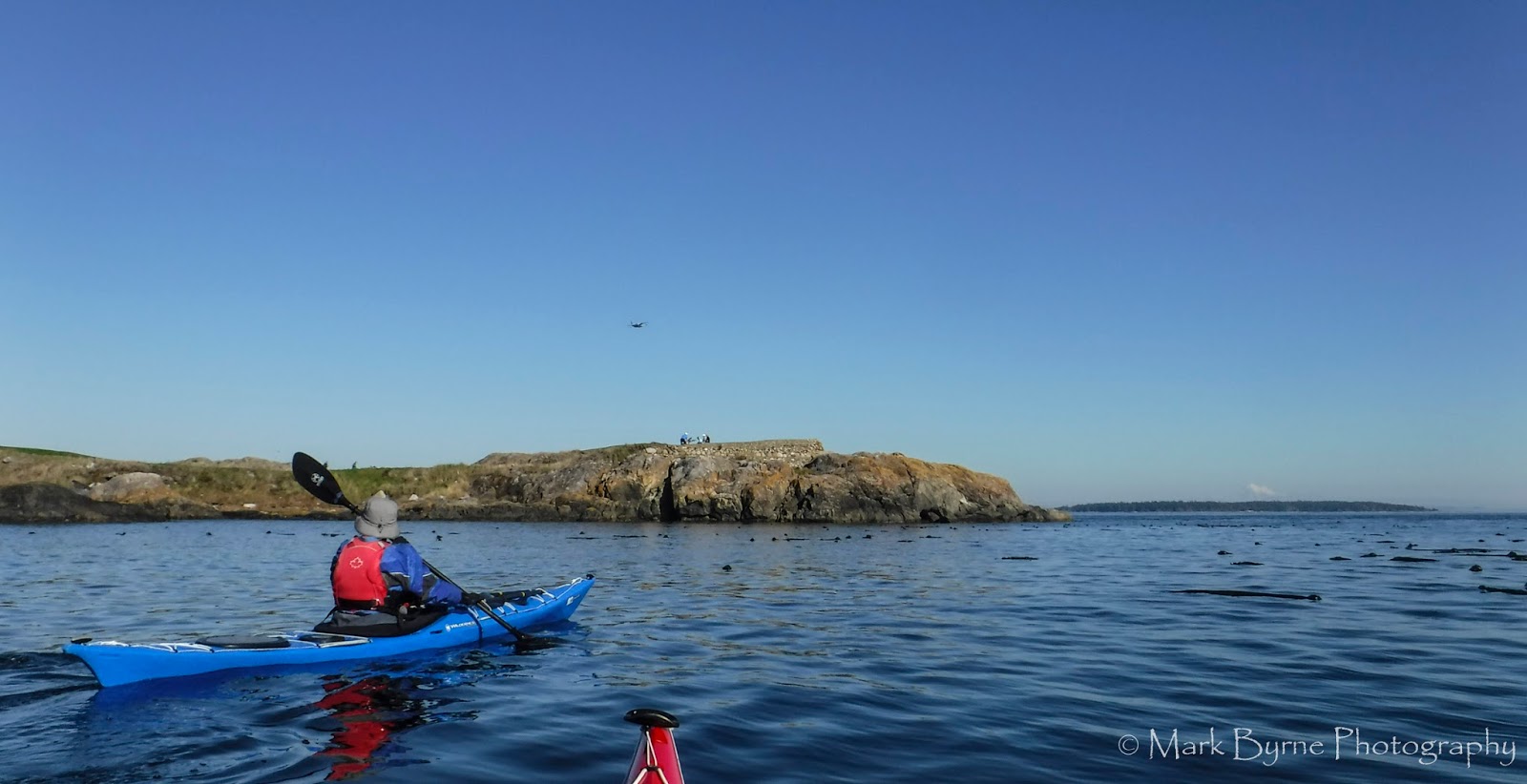
Trial Island 1 nm in the distance. Inviting to cross over so we did.

The Trial Island Lighthouse. We didn't see Meredith or her two dogs today.

Once we reached Staines Point where the lighthouse is located we checked the conditions on the west side of the island as the ebb was beginning to flow. There were no rips developing so we continued our way down the chain looking for a beach to land on below the high water mark but noticed a number of seals sunning themselves on rocks around one of our favorites places to stop.

Robyn paddling along the rock wall below the lighthouse. In all the years that we have
 been paddling it's hard to believe that Robyn has never circumnavigated Trial Island

Keeping our distance we decided to continue on back across Enterprise Channel and find a beach around the Victoria Golf Club but due to the high water levels there wasn't much to choose from.

Paddling back towards Gonzales Point. The golf course was very busy on such an amazing day.

So we continued on to Mary Tod Island otherwise know as Jimmy Chickens Island and found a wonderful gravel beach that looked out towards Chatham and Discovery Islands with Mt. Baker in the background. 

Our lunchtime view. Ahhhh .... Summer in late October!

After making note of the birds that we saw (Bald Eagles, Harlequin Ducks, Surf Scoters, Double Crested Cormorants, Pelagic Cormorants, lots of Mew Gulls but still no Buffleheads) we paddled back to the marina put in location and we both completed several rolls which capped off a perfect day on the water. 


Distance: 5.15 nm (9.53 km)

Monday, January 25, 2016

Out Of The Darkness

I can see you!!
Friday paddles .... I'm starting to love them! Last week's paddle was a little different in terms of when we decided to launch. Simply put ... it was DARK!

Fellow SISKA paddler John Minkley put together a plan to head to Discovery Island from Gyro Park (Cadboro Bay) and watch the sun rise on the way there. So our little group of 7 paddlers arrived at the park in the dark, unloaded our gear in the dark and headed out on the water at 7:30am .... in the dark. Don't worry we all had headlamps or lights on our kayaks just in case the sun didn't come up today. :-)


The forecast for that day called for variable 5-15 SE (Haro) 10-20 SW (Juan de Fuca East) with a chance of showers. But Discovery Island is right at the intersection of Haro and Juan de Fuca Straights and depending how you interpreted the information it really could mean anything was coming. Oh yeah ... we were also coming up to a max ebb in Baynes Channel of around 3 kts from a NE direction just after launch. So with all of this information at hand we decided that we wouldn't make a direct SE route to Discovery Island but instead head SW to Cattle Point to see what the wind was doing out in open water. Maybe there would be an option to cross over to the Chain Islands first on our way to Discovery Island.

Somewhere out there is Discovery Island but it is still dark.

I think we were only about 1/4 mile from the beach when we felt the increasing SW wind and then the rain came. By the time we reached Cattle Point our faces were absorbing the stinging sensation one gets when the rain falls horizontally and you are paddling into it. Our group tucked in behind Cattle Point to get out of the wind and we made the decision to follow the shoreline along Willows Beach and through the Oak Bay Marina where we would assess the conditions again.


Thankfully by the time we reached the marina the rain had stopped and the skies started to lighten up a bit and before you knew it, there was the sun! Leaving the marina I looked back at the Chain Islands and could see nothing but pretty big white caps in Plumper Passage. Just over 2 miles away, Baynes Channel was showing the effects of wind against current and even from this distance I could see huge white caps. The weather and currents had helped us make our decision so we just kept on paddling towards Gonzales Point.

Plan "B" ... Paddling towards the Victoria Golf Club and Gonzales Point

By the time we reached Gonzales we were in full sunshine but once we rounded the point we were greeted by fairly strong SW winds. After a quick discussion we decided that we would start heading back towards the marina instead of slogging through the wind. Even though our original paddle plan didn't happen that day we still enjoyed the paddle as it was one of those that gave you a little bit of everything ... even a rainbow!

Heading back towards Cadboro Bay we even saw a rainbow over Oak Bay.

We landed back at Gyro Park Beach, packed up our gear, headed for coffee at Olive Olio's and were all done just after noon. Lots of time in the day to still do whatever we pleased so Kari and I met Robyn at home and we went geocaching along the Lochside Trail. Early morning paddles certainly do have their advantages .... even if they start in the dark!  LOL


2016 Paddle #2 - Cadboro Bay
Distance: 7.24 nm (13.40 km)
YTD: 16.25 nm (30.095 km)